Have you ever been in a new location wondering where the best roads and routes are? You know, the ones the locals ride? Heatmaps are a great way to home in on the most popular routes as they aggregate data from all of the users available, and highlight the most trafficked areas. Now, Ride with GPS is bringing that technology to their mobile and web apps.
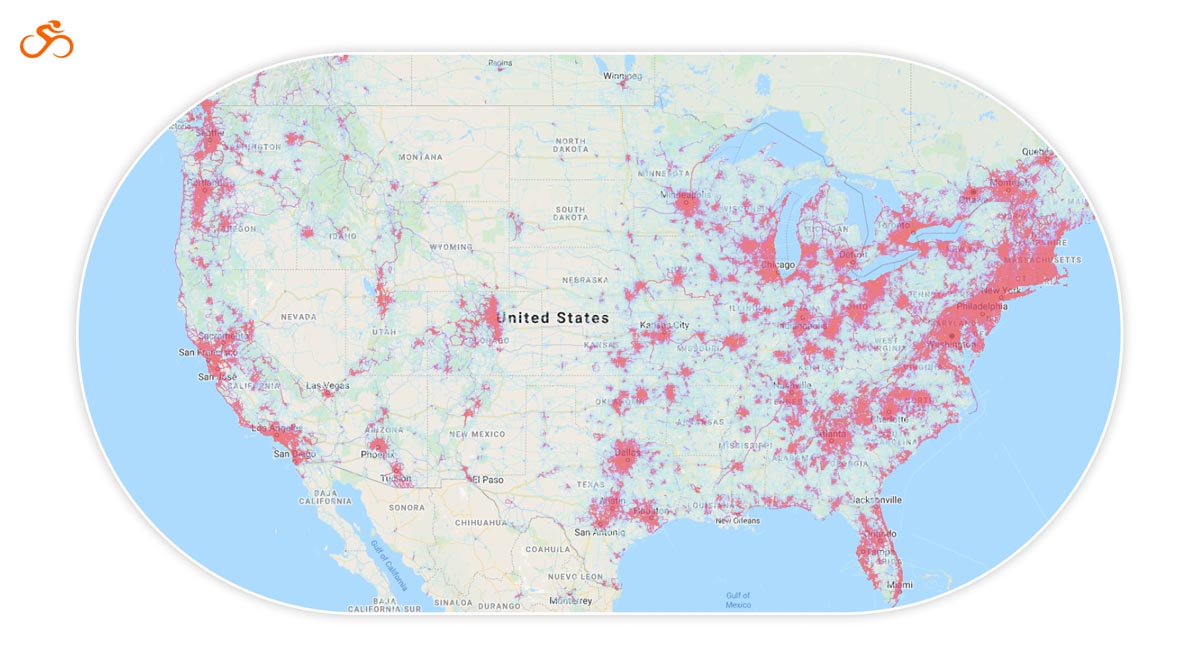
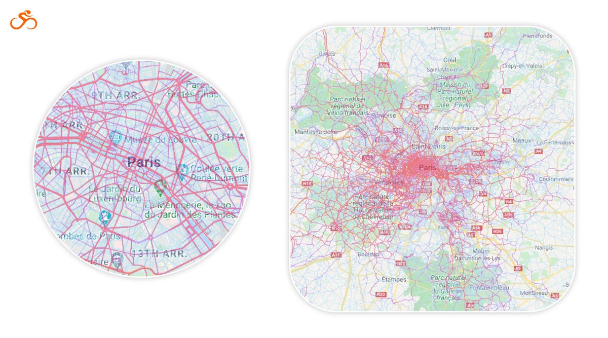
Collecting data from only publicly shared trips from the global Ride with GPS community and respecting all user-created privacy zones, RwGPS states that user privacy is “treated with utmost care.” The heatmaps will be updated weekly, and include data compiled from the previous two years of users’ rides.
“Over the years, the heatmap has been our most requested feature. We’ve heard our users loud and clear and are excited to deliver this significant upgrade,” says Cullen King, Ride with GPS co-founder. “The heatmap takes our decade-plus of experience in creating the world’s most powerful route planner and expands its capacity, giving our users visual data about where cyclists ride so they can discover, plan, and ride great routes anywhere.”
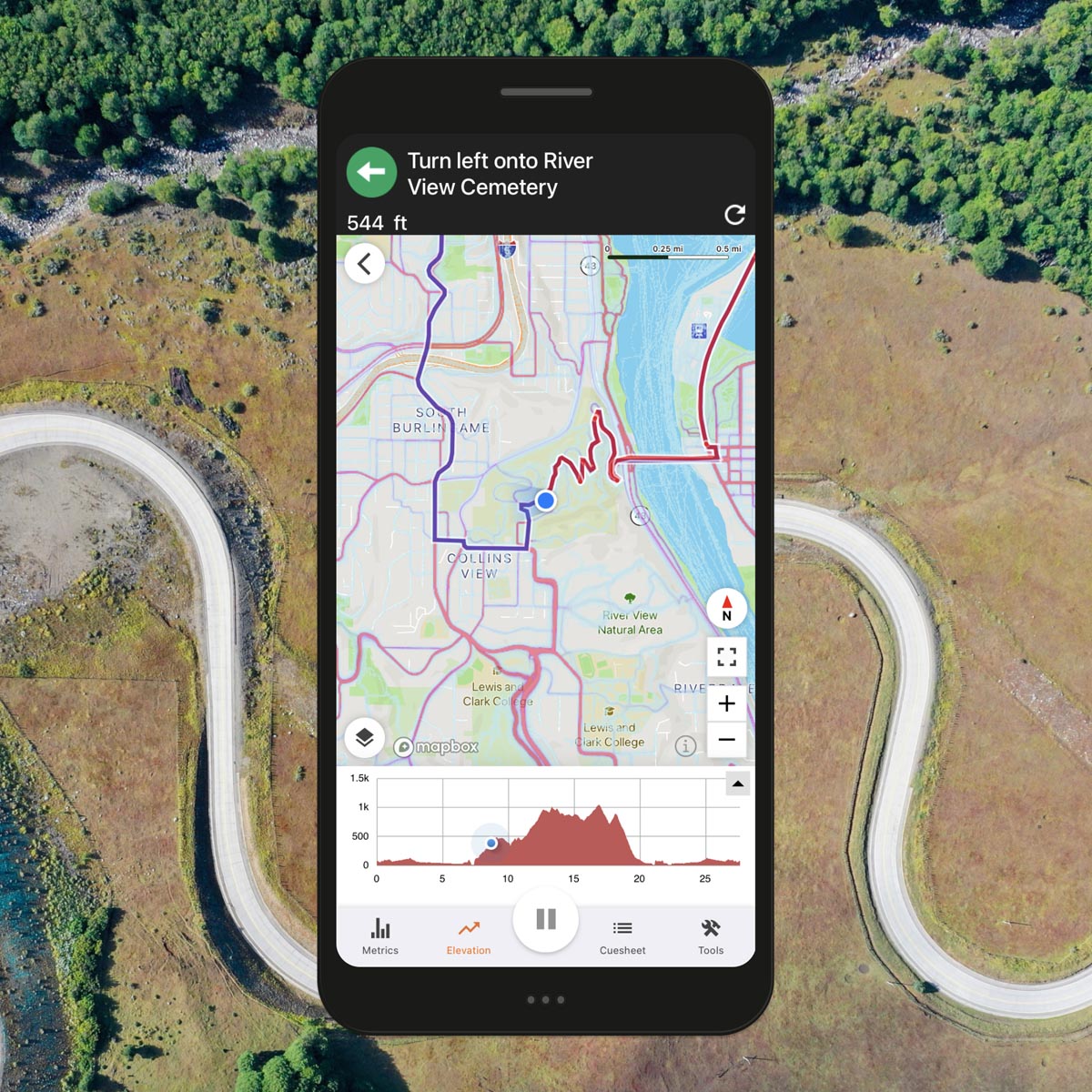
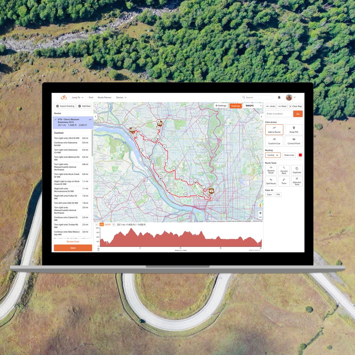
You will be able to view the heatmaps as a standalone feature, but RwGPS designed it with route creation and navigation in mind so that it overlays the route planner. This allows you to simply click on the roads most traveled to add to your route, without having to toggle back and forth. RwGPS states that “With the Ride with GPS Heatmap, cyclists can view the heatmap alongside an interactive elevation profile, while splitting and combining segments, autotracing rides into routes, color-coding segments, adding POIs and custom cues, and more.”
Available to the public without an account, the heatmaps are also accessible for members in iOS and Android mobile app recording screens, and as an overlay in mobile and web route planners for Basic and Premium members. So while everyone can see the heatmaps, only those with paid subscriptions will be able to use it in their web and mobile route planners. Additional info is available through the link below.