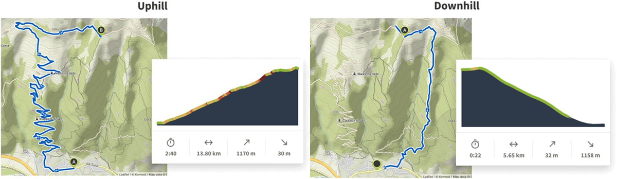
Komoot’s MTB uphill routing no longer sends you up the fastest route to the top, rather it kindly sends you the most rideable way. The new uphill routing takes into account gradient, so rather than send you up an obligatory hike-a-bike to your chosen summit, it will reroute you onto those nearby surfaced switchbacks which you actually have a chance of pedalling up. Komoot have also added new route warnings about steep gradients, restricted segments, unsuitable surfaces and steps. I put these features to the test in an area I know well.
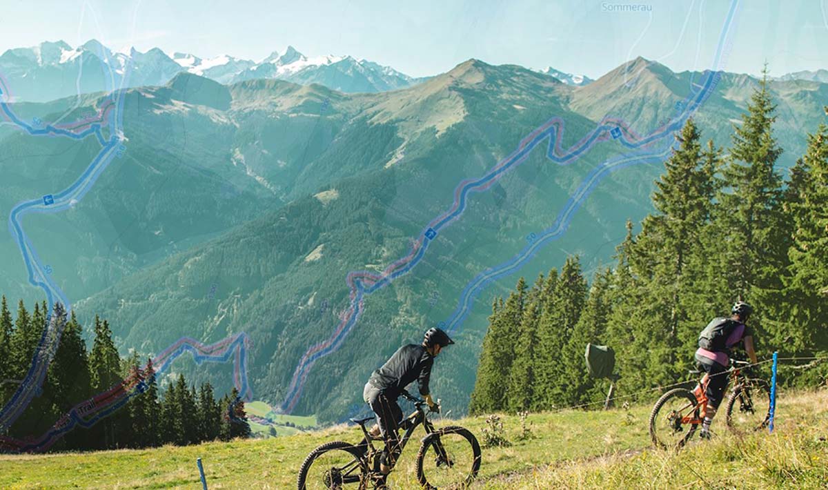
Komoot MTB Uphill Routing
I was about to plan an entire route around the Tweed Valley, Scotland, but got very frustrated very quickly when I came to the realisation that Komoot doesn’t know all the trails that I know. The Komoot map doesn’t actually “know” this particular area very well. While it uses OpenStreet Maps as its source data, it also relies on user input for trails that aren’t officially recognized, outwith trail centres. But i’m defeating the object here, aren’t I.
Riders who know an area well won’t be planning a route using Komoot, or any other route planning app for that matter. They know exactly where they are going. For me, it seems Komoot’s route planning app would be most useful to a holidaymaker who finds themselves in a new area. It will by no means replace local knowledge, that much is certainly clear. But it will give you a decent out and back, or loop, from which to get a sense of where you are in the world. If you can’t afford the services of a local guide, then Komoot is definitely worth a shot.
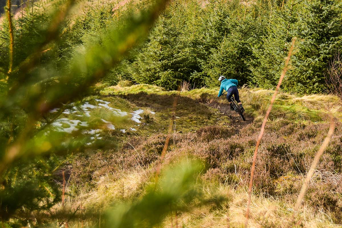
To put Komoot’s new uphill route planning to the test, I specifically asked the app to take me on a loop, via the Gold Run Downhill track at Innerleithen. The fastest way to this specific location on said downhill track would be to go straight up it, against its flow of traffic. But wait, this is a flawed test. I just logged in to OpenStreetMaps to find that these Downhill trails have a designated direction. Thus thankfully, there’s no way Komoot would send me the wrong way up an official downhill track. Instead, it takes us up a long and winding fire road, and drops us into Gold Run to ride the trail as it should be ridden, downhill, to the location set. Good to know.
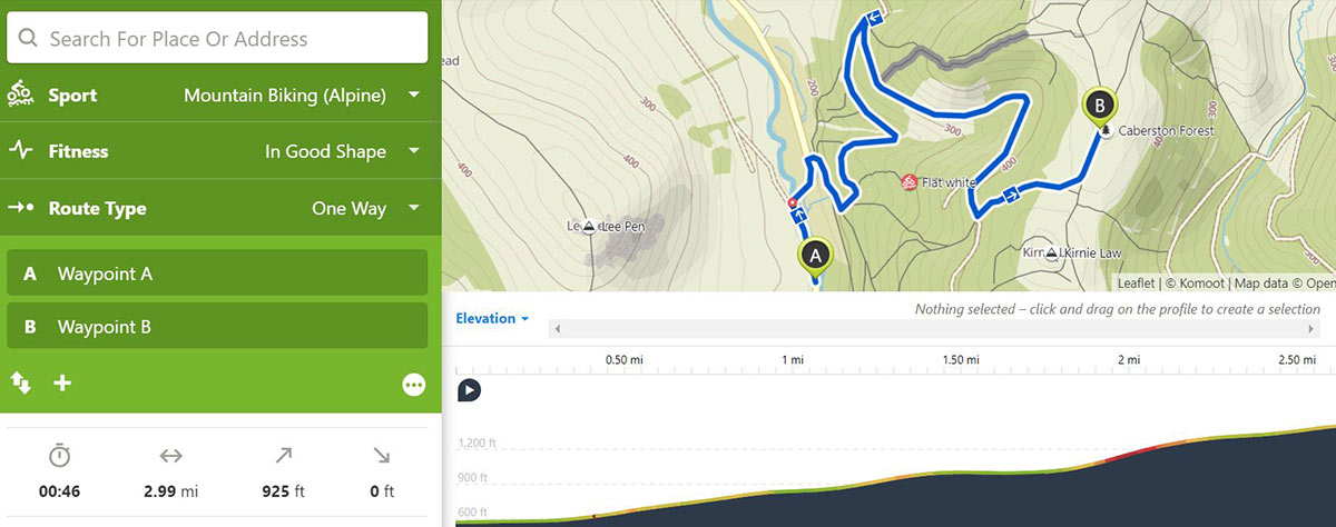
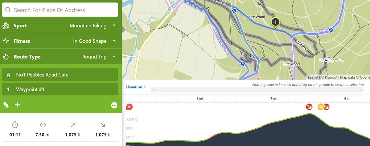
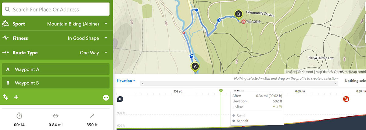
Here’s another test. I’ve asked Komoot to plan me a route from Leithen Road to the top of Caberston Forest. It has duly planned me a route following the forest road, a good gravel surface with a mellow gradient. This is by no means the most direct route. There are several trails it might have used instead, such as the popular Flat White trail. Presumably, that trail exceeds Komoot’s threshold values for gradient. And we ought to be thankful, there’s no way i’d be pedalling up that trail, not even on an e-bike.
Though Flat White also has a direction designated on OpenStreetMaps, we can trick it into sending us up it against the flow of traffic by asking it to take us only half way up, but who would do that?
Komoot’s new uphill routing essentially tries to avoid steep, unrideable segments, prioritizing gravel roads with a more gradual gradient.
For my original downhill trail loop, Komoot also added some route warnings showing me that the trail contained some steep segments, and that some segments have an unsuitable surface. Switch your route planner from “Mountain Biking” mode to “Mountain Biking (alpine)” mode, and those warnings disappear. After all, unsuitable surfaces are all part of the fun. The app tells us that the route we have chosen is Difficult. “Expert mountain bike ride. Good fitness required. Advanced riding skills necessary. Some portions of the Tour may require you to push your bike.” I’d say that’s a fair summary.
Komoot gives you an estimate of the time it will take you to complete the loop, based on how fit you say you are. We chose “In Good Shape” for the Innerleithen DH loop, and it gave us a pretty accurate estimate of 1 hour and 11 minutes. Dropping my fitness to “Couch Potato” recalculates the expected time taken to 1 hour and 40 minutes. Again, fair. Komoot also gives you mileage and elevation info, but goes further giving you a complete breakdown of the percentage of that distance spent on different surfaces and waytypes.
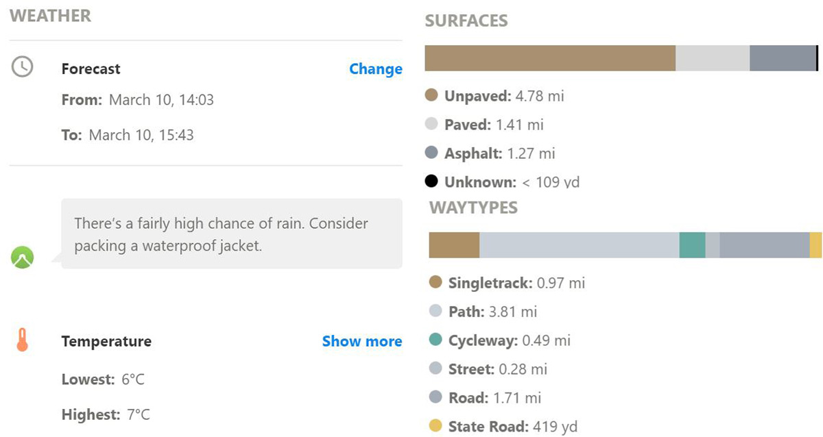 Komoot Premium features the OnTour Weather function. Tell the app when you’ve planned your trip and it will use Darksky Weather to give you a forecast. Well blow me down, it’s going to be raining here tomorrow… This feature would be particularly useful for planning multi-day trips. Instead of having to find a forecast for every location along your journey, Komoot imports one for you so you have all the relevant information you need in one place. Could be useful for avoiding head winds, hail storms, thunder and lightning, etc.
Komoot Pricing
Komoot is free to download and use. With the free version, maps can be purchased for offline use for £3.99, £5.99 (bundle) or unlock the world for £29.99. These are all one-off payments. A subscription to Komoot premium will set you back €59,99, annually. Check out this article for more information on Komoot Premium, or head to the Komoot website.