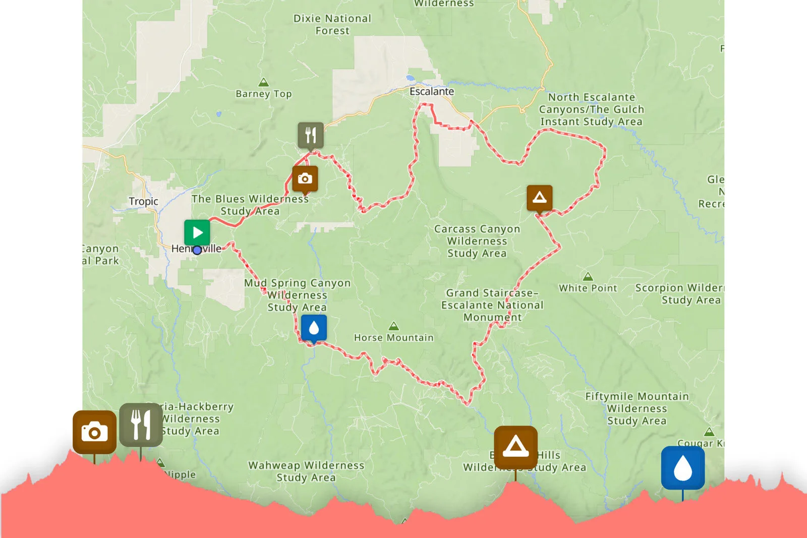
Got a favorite stop along your ride? Or want to get a reminder when you’re coming up on that killer cafe or swimming hole? Now you can drop waypoints into your route on RideWithGPS, and they’ll show up on the map, in your elevation profile, and on your cycling computer.
The new Waypoints feature lets you add points of interest, whether that’s a restaurant, water stop, campsite, or whatever, while building your route in RideWithGPS.
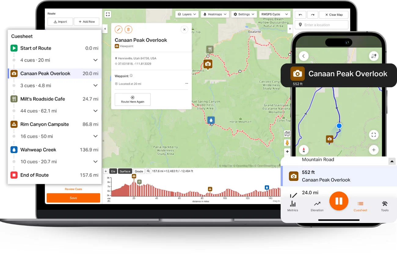
That Waypoint is then added to the route data, so they export along with the route as actual data. RWGPS says this allows them to appear in cue sheets, elevation profiles, maps, and anywhere else you’re viewing your ride.
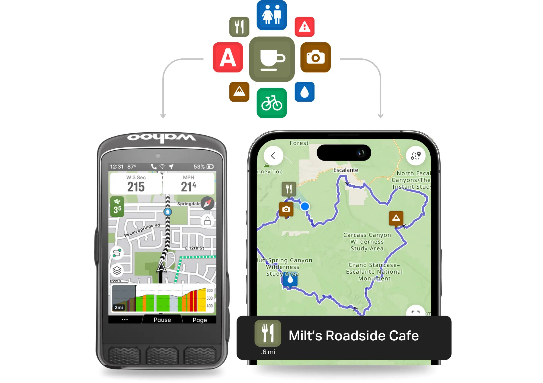
When adding them, you can name each Waypoint and add an icon to make it easy to recognize at a glance. Icons for water, food, camping, and other options give you a quick visual reference, particularly helpful on smaller GPS cycling computer screens.
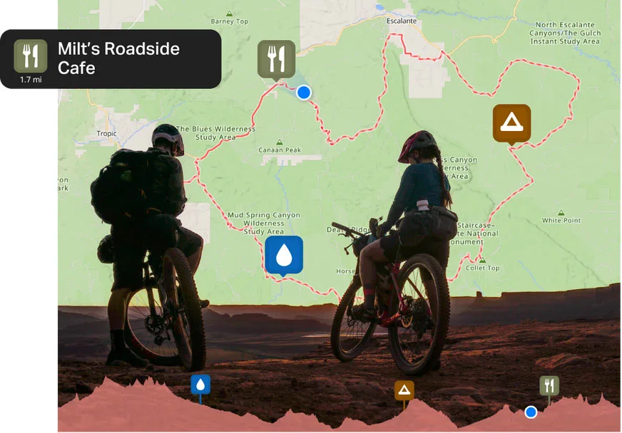
And if you’re using their app to navigate, you can even get audible cues when approaching a Waypoint, too!
Each Waypoint can also have notes, a URL, photos, and other details, so if you’re viewing them on your mobile app or the computer, additional info is right there within the route. Waypoints even show up in embedded routes, so anyone you share the route with can see all of the added info, too, helping them plan when joining or replicating your ride.
These new Waypoints are compatible with Garmin, Wahoo, Hammerhead, and Coros devices, as well as RWGPS’ mobile app.