I suppose all of this was only ever a Google search away, but now that I’ve been using the Wahoo ELEMNT and it’s ability to add GPX route files in the most insanely easy way, I’ve found myself actually wanting to upload GPX files to a cycling computer…simply because it’s now so darn easy.
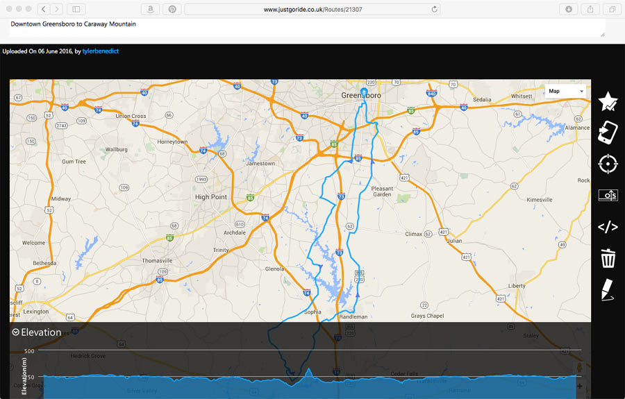
The hard part then became creating the files without paying for a subscription, because I’m frugal, which led me to the UK site JustGoRide. It lets you overlay a route on Google Maps, showing distance and elevation (in kilometers and meters, respectively) as you mark it, then export it all as a GPX file for free…
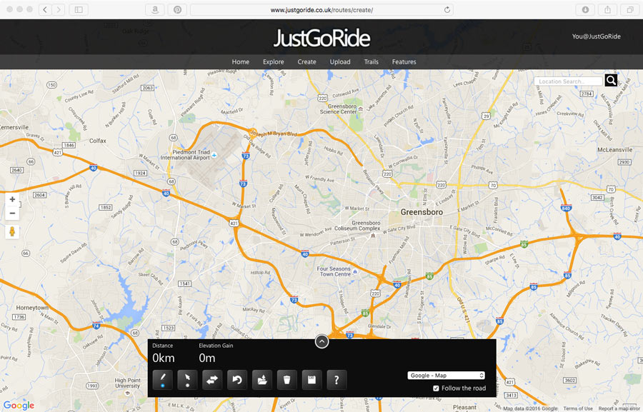
To get started with JustGoRide, you’ll need to create a free account, which took 30 seconds.The top pic shows the editing tools, which include a very helpful Undo button. Just point on the roads you want to ride, click, and it connects the dots. When finished, click save and it’ll give you the option of sending it directly to a Garmin device, or exporting as a GPX. The catch is, it downloads as a .gpx.xml file, which wouldn’t actually transfer to the ELEMNT. And, simply changing the file name on the downloaded file to remove the “.xml” part of that didn’t solve that problem.
Sooooo, you just open a new tab, type in GPSvisualizer.com, hit enter, upload the XML file and select GPX for conversion result. Boom, it creates it in about a second, gives you a link to download the new GPX file, and then it easily gets added to the Wahoo ELEMNT. Or whatever other device you may have.
A very mature alternative is the excellent http://www.ridewithgps.com site. Well worth a look. Free, as well. And several choices of maps, satellite, OSM in different tastes, topos…
Yup, ridewithgps.com is pretty awesome…….so long as you don’t mind paying $10/month to have the ability to download your .tcx/.gpx files to load onto your bike computer.
Robin – “so long as you don’t mind paying $10/month”
You don’t need to pay to use RidewithGPS the free version is very good. Just Export your .tcx or .gpx route and save it to the NewFiles folder on your Garmin. The paid version can add more and custom cue entries but I’ve never needed them.
I’ve tried just about all routeing sites out there and find RidewithGPS by far the best. Because it uses Google routeing services you can send updates to Google and get things like misrouted bike paths fixed and the fix just flows through. Certainly for my general area (UK) because Streetview has been almost everywhere you can drag the little man over the route and see if any roads don’t turn blue. If they don’t it’s a good bet that it’s a gravel track or bridal way that the Google car couldn’t go up.
‘just created a track – worked. But overall I can see nothing that is better than on GPSies.com
Plotaroute (plotaroute.com) allows you to do similar, as well as download direct into TCX for upload directly into Garmin units. It’s worth checking out.
Oh, c’mon, http://www.gpsies.com/ is free and gives you even more than you’d ever need for creating/importing routes.
Or you can do it all in gpsvisualizer.com. Or the excellent bikemap.net. Both are free. I use them to create routes for BKOOL simulations when I can’t find what I want on Strava or ridewithgps.com.
I’ve been using ridewithgps.com for years. It has a lot of the routes you would want when you are new to an area, lots of endurance rides/races, the eurovelo routes – great site!
i create routes on strava and it’s stupid easy. i just click to drop down a way point, then let their heatmap-based algorithm decide how i should get there
The problem I have with most route creators is that it’s hard to tell pave roads versus gravel roads via satellite imagery visually since they reflect light similarly. It would be a great service if one of these apps could incorporate road composition data in their routing.
Yeah,does anyone else have a good source for maps that distinguish paved from unpaved roads? I am in New England, and haven’t found a good source for this area.
Wouldn’t it be more appropriate to call this website justsitinfrontofyourcomputerwastingtimeinsteadofriding.com ? (says the guy reading bikerumor)
I use Strava to create routes as well. It’s stupid easy and the heat maps give you hints new places to check out. I don’t know if it’s just a premium feature, but it’s easy and convenient.